Our Echo Canyon headquarters is located near Cañon City, Colorado Springs, Pikes Peak and the Air Force Academy. For details or directions to our other locations please see additional information below.
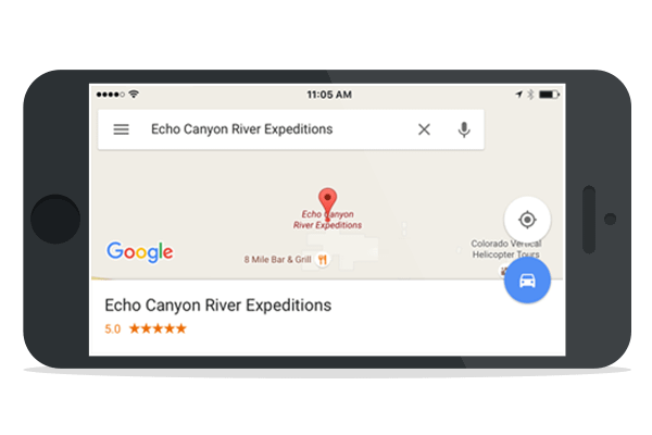
Bring up Echo Canyon in your maps application on your mobile phone. Launch Map App »
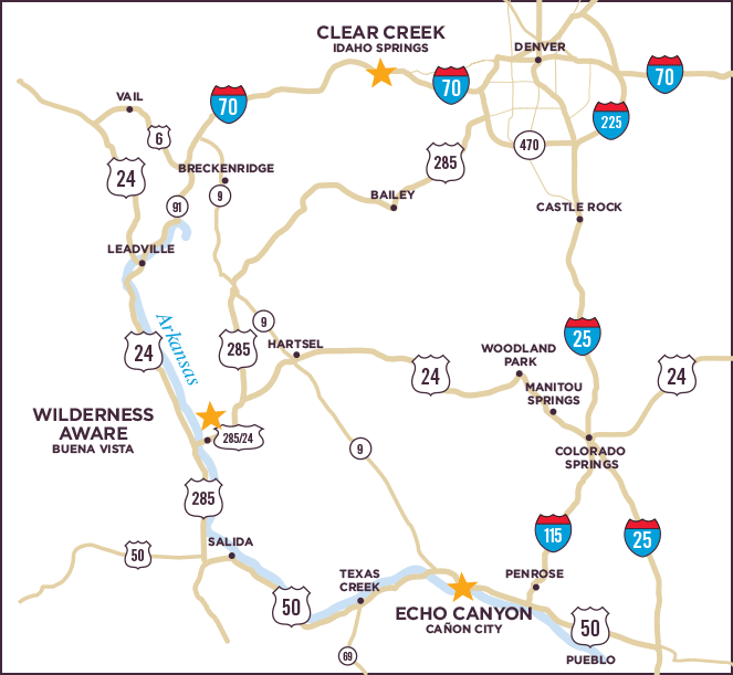
Physical Address: 45000 West U.S. Highway 50, Canon City, CO 81212
Please note Bighorn Sheep Canyon, Royal Gorge, Family Float and Raft-n-Rail trips depart from this office. We offer other packages that depart from either the Echo Canyon office or one of our vendor partner’s location. Check your email confirmation to be sure you arrive at the correct office for your scheduled activity. Please call us at 800-755-3246 if you are unsure of the office location from which your trip departs.
Take Academy Blvd. south (it eventually curves to the west and goes under I-25). Stay in the left lane for about one mile and make a left onto Hwy 115 heading south.
Proceed south approximately 30 miles through Penrose to U.S. Hwy 50. Turn right (west) on Hwy 50 and continue through Cañon City. Eight miles west of Cañon City you will find Echo Canyon River Expeditions located between mile markers 270 and 271 on the north side of U.S. Hwy 50.
Take I-25 South through Colorado Springs to exit 140. After exiting I-25 proceed to the second light and make a right onto Nevada Avenue, which becomes Hwy 115.
Proceed south approximately 30 miles through Penrose to U.S. Hwy 50. Turn right (west) on Hwy 50 and continue through Cañon City. Eight miles west of Cañon City you will find Echo Canyon River Expeditions located between mile markers 270 and 271 on the north side of U.S. Hwy 50.
Head south on Nevada Avenue, which becomes Hwy 115.
Proceed south approximately 30 miles through Penrose to U.S. Hwy 50. Turn right (west) on Hwy 50 and continue through Cañon City. Eight miles west of Cañon City you will find Echo Canyon River Expeditions located between mile markers 270 and 271 on the north side of U.S. Hwy 50.
Take Hwy 24 East to Nevada Avenue and head south. Nevada Ave. becomes Hwy 115.
Proceed south approximately 30 miles through Penrose to U.S. Hwy 50. Turn right (west) on Hwy 50 and continue through Cañon City. Eight miles west of Cañon City you will find Echo Canyon River Expeditions located between mile markers 270 and 271 on the north side of U.S. Hwy 50.
ECHO is about 2 hours from the intersection of I-25 and C-470. From this point take I-25 South from Denver through Colorado Springs to exit 140. After exiting I-25 proceed to the second light and make a right onto Nevada Avenue, which becomes Hwy 115.
Proceed south approximately 30 miles through Penrose to U.S. Hwy 50. Turn right (west) on Hwy 50 and continue through Cañon City. Eight miles west of Cañon City you will find Echo Canyon River Expeditions located between mile markers 270 and 271 on the north side of U.S. Hwy 50.
Take Hwy 50 East approximately 55 miles. After you leave the river corridor and climb a large hill you will find us on the left hand side of the highway between mile marker 270 and 271.
Take Hwy 9 South over Hoosier Pass through Fairplay. To stay on Hwy 9 you will need to make a right at the end of town followed by a left shortly after you leave the Fairplay area following the signs to stay on Hwy 9. The next town you come to is Hartsel. Follow the signs through the town of Hartsel, as you will be making a right in order to stay on Hwy 9. Hwy 9 will dead-end with Hwy 50 forty-seven (47) miles after you leave Hartsel. Turn left (east) onto Hwy 50 and proceed 1.5 miles. We are on the left hand side (the north side of the highway) between mile markers 270 and 271.
Physical address: 12600 Hwy 24/285, Buena Vista, Colorado 81211
Please note Browns Canyon and Numbers trips depart from this office. Please call us at 800-755-3246 if you are unsure of the office location from which your trip departs.
Take I-70 west to C470 to Hwy 285 south (in Denver Hwy 285 is called Hampden Road) 89 miles towards Buena Vista. About 13 miles before your destination you’ll pass the Hwy 24 junction. Look for the Wilderness Aware Rafting office on the right side of the road, just before the Arkansas River. (About 2 hours)
Take Hwy 24 west out of Colorado Springs. Continue west on Hwy 24 for 76 miles. Turn left onto US Hwy 24 West and continue about 13 miles. Wilderness Aware Rafting is on the right side of the road, just before the Arkansas River. (About 1 hour 40 minutes)
Take Hwy 9 south to Fairplay. Turn right onto Hwy 285 South and continue about 34 miles. About 13 miles before your destination you’ll pass the Hwy 24 junction. Look for the Wilderness Aware Rafting office on the right side of the road, just before the Arkansas River (about 1 ½ to 2 hours)
Physical address: 431 Chicago Creek Road, Idaho Springs, CO 80452
Please note all Clear Creek trips depart from this office. Please call us at 800-755-3246 if you are unsure of the office location from which your trip departs.
Echo Canyon River Expeditions
45000 W US Highway 50
Cañon City, CO 81212
800-755-3246
Info@Raftecho.com
News & Deals
"*" indicates required fields